National Parks · Arizona
Grand Canyon National Park
National Park Service source material · single source. Source dates and reuse information are available beside each field.
Check the official park website for current access, conditions and visitor information.
Introduction
Background: 1
Entirely within the state of Arizona, the park encompasses 278 miles (447 km) of the Colorado River and adjacent uplands. Located on the ancestral homelands of 11 present day Tribal Communities, Grand Canyon is one of the most spectacular examples of erosion anywhere in the world—a mile deep canyon unmatched in the incomparable vistas it offers visitors from both north and south rims.
Geography
Designation: 4
National Park
State or territory: 5
Arizona
Park Map - Grand Canyon National Park: 6
Map scope: Grand Canyon National Park
Map of Grand Canyon National Park in Arizona. Outlined in green, the park follows the shallow, sideways S-curve of the Colorado River across the middle of tan-colored terrain. Dozens of peaks, plateaus, points, overlooks, cliffs, gorges, bodies of water, reservations, valleys, and other sites are labeled across and around the park.
History and culture
Interpretive Themes for Artist and Author: 7
The immense and colorful Grand Canyon is valued worldwide as one of the Earth’s most powerful and inspiring scenic landscapes, offering people enriching opportunities to explore and experience its wild beauty in both vast and intimate spaces. Grand Canyon’s immense and richly colored scenic vistas, enhanced by a near-pristine natural setting, inspire a variety of emotional, intellectual, artistic, and spiritual impressions.
Water is the lifeblood of Grand Canyon — a force of erosion, a sustainer of scarce riparian habitat in a desert environment, a spiritual element for native peoples, a provider of recreation, and a central factor in the exploration, development, and politics of the American West.
The Colorado River and other erosional forces sculpted the southern edge of the Colorado Plateau to form the Grand Canyon, revealing a beautiful sequence of rock layers that serve as windows into time. The Grand Canyon of the Colorado River is the world’s greatest example of arid land erosion and one of the most spectacular exposures of stratified rocks.
Extreme changes in elevation, exposure, and climate in the Grand Canyon support a remarkable range of biotic communities in unusual proximity; a relatively undisturbed ecosystem that allows natural processes to continue, providing sanctuary for present and future life.
Grand Canyon’s extensive sedimentary strata and dry caves preserve a remarkable record of past plant and animal life.
Grand Canyon’s extreme and abrupt changes in elevation, exposure, and climate support a diversity of communities ranging from desert (including three of the four North American deserts) to boreal forest in unusual proximity. Early investigations into the biology of the Grand Canyon led to the development of fundamental ecological principles, including:
Grand Canyon is the home of ten threatened or endangered species including the humpback chub, the California condor, and the sentry milkvetch.
Grand Canyon has sustained people materially and spiritually for thousands of years – wider recognition of its value led to its designation as a national park and world heritage site; however, continuing threats to its preservation generate dialogue about our need and responsibility to conserve our local and global environment.
Grand Canyon’s cultural history is a study in exploration, exploitation, development, and preservation of land in the American West.
Grand Canyon has played, and continues to play, a pivotal role in precedent-setting conservation issues, including air quality, natural quiet, fire ecology, and adaptive river management.
The United Nations Educational, Scientific, and Cultural Organization (UNESCO) designated Grand Canyon National Park as a World 79, recognizing it as a place of universal value under natural world heritage site criteria to be preserved as a part of age of all peoples.
Grand Canyon is a homeland and a sacred place to a number of American Indian cultures, a point of emergence for some, offering us an opportunity to consider the powerful and spiritual ties between people and place.
A variety of American Indian cultures, past and present, are represented in and around Grand Canyon.
People: 8
People have been part of Grand Canyon's history and culture from 10,000 years ago through today. Eleven contemporary tribes have cultural links to the area, and their oral histories are rich with references to the creation of that great chasm and torrential river. From the sixteenth century on, tribes familiar with the region were guides and informants for Spanish and later Euro-American explorers. The quiet area of the South Rim rapidly expanded into the Grand Canyon Village when entrepreneurs and miners came hoping to make a fortune. Passing through or calling the canyon home, many people have influenced the development and protection of Grand Canyon for themselves, for visitors, and for the National Park Service.
Places: 9
The National Register of Historic Places is the Nation's official list of historic places worthy of preservation. Authorized by the National Historic Preservation Act of 1966, the National Register is a national program to coordinate and support public and private efforts to identify, evaluate, and protect our historic and archeological resources.
Properties listed in the Register include districts, sites, buildings, structures, and objects that are significant in American history, architecture, archeology, engineering, and culture. Currently 95,000 listings have been nominated by governments, organizations, and individuals because they are important to a community, a state, or the nation.
Collections: 10
The library is currently closed to the public. The library contains a comprehensive collection about Grand Canyon and related subjects, including books, periodicals, government documents, reports, pamphlets, DVDs, CDs and videos.
Checkout privileges are extended to National Park Service employees and interns, Volunteers-in-the-Parks, Albright Training Center staff and students, Grand Canyon Semester students, Grand Canyon Unified School District faculty and students, and Grand Canyon Comservancy members. More...
The Collection preserves objects for research and exhibit purposes in order to document the area's unique cultural and natural history. Grand Canyon National Park staff has been preserving natural and cultural history items since the park was created in 1919.
The Museum Collection focuses on objects from the Grand Canyon region. There are over 900,000 objects in seven different collections: archeology, ethnology, biology, paleontology, geology, archive manuscripts, and history. More...
Whose Story Is History?: 11
The stories of marginalized communities often go without recognition and appreciation. Grand Canyon has incredible stories of art, resilience, activism, and courage. The park also has challenging and uncomfortable histories of injustice and exclusion. Exploring all of these stories provides a more complete understanding of Grand Canyon history. Dive into the Whose Story is History Project with articles centered around historically underrepresented narratives and perspectives.
Why are some legacies preserved and others ignored? How can we give due value to all the voices and perspectives at Grand Canyon?
Associated Tribes: 12
The Grand Canyon is a place of immeasurable importance to Native people in the Southwest. The park shares boundaries with three federally recognized Tribes; a total of 11 federally recognized Tribes are traditionally associated with what is now Grand Canyon National Park. Park staff have been working with Tribal communities for more than 40 years, developing numerous innovative and collaborative tribal partnerships during that time. We gratefully acknowledge the Native peoples on whose ancestral homelands we gather, as well as the diverse and vibrant Native communities who make their home here today.
There are 11 Tribes that have historic connections to the lands and resources now found within Grand Canyon National Park.
Explorers: 13
Early European and American explorers of Grand Canyon and Colorado River were willing to go into "The Great Unknown" risking their lives to learn the canyon's secrets. They were the first to document the power of the Colorado River, understand the immense size of Grand Canyon, and share its beauty and danger with the world. Their adventures still inspire explorers today.
The first Europeans to see Grand Canyon were soldiers led by García López de Cárdenas. In 1540, Francisco Vázquez de Coronado and his Spanish army traveled northward from Mexico City in search of the Seven Cities of Cíbola. After traveling for six months, Coronado’s army arrived at the Hopi Mesas, east of Grand Canyon. Cárdenas, guided by the Hopi, led a small party of men to find a reported “great river.” Coronado hoped to find a navigable river that would serve as a waterway to the Gulf of California. The Hopi leaders advised their men to guide the unwelcome soldiers along an exaggerate path to the highest point above the river and to volunteer no information of value. After a twenty-day journey, Cárdenas and his army arrived at the edge of Grand Canyon. Approximately a mile down was the Colorado River below them. The Spaniards estimated that the opposite rim was 8 to 10 miles away and that the Colorado River was no more than 6 feet across. Cárdenas ordered three infantry men to climb their way down to the river. The men made it about 1,500 feet down, a third of the way, until they saw that the Colorado River was much wider waterway than they had estimated and that there was no way to navigate ships along this intense river. Cárdenas' party spent three days looking for water and trying to reach the bottom of the river. The Hopi were able to fool the Spaniards into thinking that the area was an impenetrable wasteland and was not navigable anyway. Due to this response, Coronado dismissed further western exploration, and moved his men out east to Texas. Grand Canyon was left unexplored by Europeans for 235 years.
1857-1858 Grand Canyon was the last largely unexplored area of the West in 1857. Often called "The Great Unknown" it was literally a blank space on maps. It was known that the Colorado River made a significant portion of its journey through this area, so the federal government funded an expedition to explore the river and determine its usefulness as a trade route.
Army First Lieutenant Joseph Christmas Ives of the U.S. Army Corps of Topographical Engineers would embark on this challenge and become the first European American known to reach the river within Grand Canyon. Joseph Christmas Ives would navigate up river using a fifty-foot long sternwheel steamboat, the Explorer . His plan was to steam up the Colorado River from the known into the unknown. However, he crashed just below Black Canyon, not yet in Grand Canyon itself, but continued upriver for another thirty miles in a skiff. Continuing on foot, his overland journey took him down into the canyon at Diamond Creek, today part of the Hualapai Indian Reservation.
In his Report upon the Colorado River of the West; Explored in 1857 and 1858 (Washington: GPO, 1861), Ives admires the canyon’s scenery:
"The extent and magnitude of the system of canyons is astounding. The plateau is cut into shreds by these gigantic chasms, and resembles a vast ruin. Belts of country miles in width have been swept away, leaving only isolated mountains standing in the gap. Fissures so profound that the eye cannot penetrate their depths are separated by walls whose thickness one can almost span, and slender spires that seem to be tottering upon their bases shoot up thousands of feet from the vaults below."
But he could not envision that the scenery alone would bring millions to view the wonder of the canyon. He also writes:
"The region is, of course, altogether valueless. It can be approached only from the south, and after entering it there is nothing to do but leave. Ours has been the first, and will doubtless be the last, party of whites to visit this profitless locality. It seems intended by nature that the Colorado river, along the greater portion of its lonely and majestic way, shall be forever unvisited and undisturbed."
It wasn’t until 1869 that another explorer would take on the Colorado River through Grand Canyon. John Wesley Powell was a geologist whose studies of rocks in Colorado and Wyoming sparked his interest in exploring the unknown canyon of the Colorado River. He studied reports from Ives’ expedition, gathered support and supplies from the Smithsonian Institution, railroads, educational institutions, and convinced Congress to authorize the use of rations and supplies from army posts. He designed his own boats and gathered a makeshift crew of ex-trappers, mountain men, and Civil War veterans like himself. The expedition launched four boats from Green River, Wyoming in May 24, 1869. Starting off with ease, the river quickly gained momentum and began to bare its teeth. One boat and all its supplies were lost at Lodore Canyon in a rapid Powell named Disaster Falls.
After three summer months spent exploring the upper canyons of the Colorado River, the expedition passed the Paria River on August 4, hungry, with only musty apples, spoiled bacon, wet flour, and coffee remaining, and both physically and mentally tired, as they entered the last and greatest of the canyons. The scientific expedition had turned into a fight for their very survival. In his published account of the river expedition, The Exploration of the Colorado River of the West and its Tributaries (Washington: GPO, 1875), Powell referred to Grand Canyon as “our granite prison” and described an almost unbroken series of rapids that the expedition ran, lined, or portaged, praying all the while for an end to the ordeal. On August 28, the canyon ended and the river became relatively quiet once again. So many of Powell’s notes had been lost, however, that with full federal funding, Powell gathered another crew, this time of amateur scientists and educated men, and began a second expedition on May 22, 1871 from Green River, Wyoming, entering the Grand Canyon at Lee’s Ferry on August 17, 1872 after wintering in Kanab, Utah.
Find out more about the Powell Expedition with these books available at the Grand Canyon Conservancy's Online Bookstore:
Miners: 14
Prospectors and miners came to Grand Canyon to discover and extract its resources, but many found the tourist industry more profitable. In addition to maintaining claims in the canyon and building trails to provide access, enterprising miners started offering guided tours and set up tent camps or hotels, providing the first visitor services at the canyon.
1890-1987 Dan Hogan was in the first group of prospectors to come to Grand Canyon from Flagstaff in 1890. He and some friends are the first known hikers to complete a rim-to-rim-to-rim backpacking trip through the central corridor in 1891. But his adventures were only getting started.
In 1893, Hogan registered the “Orphan Lode” or “Orphan Mine,” located 1,000 feet below Maricopa Point and on 20.64 acres of scenic property less than two miles west of today’s village. Four acres abutted the canyon edge while the remainder plummeted to the copper mine’s shaft in the cliff face below. Hogan constructed two trails to his claim. The Battleship Trail followed the upper 1.4 miles of the Bright Angel Trail before traversing below Maricopa Point another 3.5 miles to the mine site. Another trail consisted of ropes, ladders, and toe holds chiseled into the side of the cliff from the rim directly above the mine site. Few other than Hogan used what he called "The Slide" and others called the Hummingbird Trail. You had to be a hummingbird to hang on! Hogan not only had the mine, he was able to build tourist facilities uncontrolled by the National Park Service. In 1936 he opened the Grand Canyon Trading Post, eventually adding cabins and a saloon. World War II ended his mining and tourism business, and Hogan sold out to Madeleine Jacobs in 1946.
Jacobs operated the tourist facilities with little interest in the mine until 1951 when it was discovered that the black rock she had been kicking aside was actually some of the richest uranium in the Southwest. The Orphan Mine became one of the most productive uranium mines in the region, in operation from 1953-1969. An 1,800 foot long cable tram was added in 1955. A large "bucket" carried miners down and back from the rim to the mine opening in the cliff below, and hauled out the excavated ore. Each bucket could hold 800 pounds of ore, with an average of 1,000 tons removed each month. In 1959, to meet higher safety standards and increased production demand, the cable tram was replaced by an elevator and load car operated from a large headframe. A 1,500 foot vertical shaft was drilled straight down from the rim to the mine site. Miners had a long, dark ride into the mine below. Ore production increased to almost 9,000 tons each month.
In the late 1950s, the mining company sought permission to extend the operation beyond the mining claim and into federal property. To speed the approval process they proposed an 18 story, 800 room hotel overhanging the rim. This grand hotel would spill “down the side of the precipitous cliff like a concrete waterfall” ending at a swimming pool and sun deck below. Because of the controversy over the extended mining operations and the unprecedented hotel plans, Congress passed a law in 1962 that allowed a compromise. Mining could continue, but tourist operations were prohibited after 1966 and all mining would cease by 1987, when the property would then pass to the federal government. Mining actually stopped by 1969 when the market for uranium declined and shipping costs for the ore increased. When the mine closed it had produced 495,107 tons of ore, including 4,257,571 pounds of uranium oxide, 6,680,000 pounds of copper, 107,000 pounds of silver, and 3,283 pounds of vanadium oxide. The value of the uranium alone has been estimated at $40 million.
One of the early miners to settle in Grand Canyon, Louis Boucher was called the "hermit" by some because he not only lived alone but made his home beneath the canyon rim in an isolated alcove at Dripping Springs. He set up a small tent camp and corral at this perennial water source, continuing to build trails and search for copper deposits.
Boucher built the Silver Bell Trail (today's Hermit Trail and spur to Dripping Springs ) and the Boucher Trail down to the Colorado River. Backpackers staying along Boucher Creek can still find evidence of his second camp near a copper mine, with remnants of stone cabins and outbuildings, near where he also planted a small garden and orchard. During the 1890s Boucher worked several mining claims but also began leading tourists to his small camps. When the railroad brought increased tourist business to the South Rim in 1901, Boucher was better to able to make ends meet with tourism dollars and work he did for friends such as Pete Berry, John Hance, and Niles Cameron.
Boucher left the canyon in 1909, selling the upper portion of his trail to the Santa Fe Railroad and Fred Harvey Company. Between 1911 and 1913 the railroad developed the "Hermit Trail" into the best constructed trail at the canyon, with cobblestone pavement and cement corrugation for better traction. Tourists traveled down the trail by mule to Hermit Creek where Hermit Camp offered visitor services such as tent cabins, restrooms, showers, and a Fred Harvey chef to cook meals.
By 1925, a cable tram was installed from Pima Point to Hermit Camp 3,600 feet below. It was said to be the longest single-span cable tram in the United States at 6,300 feet in length. It was also the only tourism tramway that went from the rim to the inner canyon. Hermit Camp closed in 1930. Remnants of the stone corral and cable system structures can still be seen by backpackers today.
Hiking the Hermit Trail? A must have for its history, geology, and natural features is this trail guide available at the Grand Canyon Conservancy Bookstore:
They registered the trail as the Bright Angel Toll Road but, until the railroad arrived in 1901, a toll was never actually collected. While Cameron focused more of his energies in the Bright Angel area, Berry continued to develop mines on Horseshoe Mesa as well as tourist facilities on the rim. He and his wife, Martha, opened the Grandview Hotel in 1897. This two-story lodge catered to increased numbers of visitors arriving by stagecoach from Flagstaff and was marketed at the time as the "only first-class hotel at the Grand Canyon."
The Berry's were very successful until the railroad's arrival in 1901. With the train terminus many miles to the west, and visitors more likely to use the cheaper, more comfortable, and quicker railroad service rather than the stagecoach, business for the Berry's dwindled rapidly. In 1913, after several attempts with other ventures, Berry sold his homestead and mining claims to William Randolph Hearst. Despite threats to build luxury hotels, Hearst used the property mainly for cattle grazing.
The Grandview Hotel was torn down in 1929 and the park service was able to purchase the properties on and below the rim in 1941. Today hikers can still travel the historic Grandview Trail to Horseshoe Mesa where mining debris slowly deteriorates, yet stubbornly remains as a reminder of the most successful copper mine at Grand Canyon.
Hiking the Grandview Trail? A must have for its history, geology, and natural features is this trail guide available at the Grand Canyon Conservancy Bookstore:
One of the most controversial figures in the history of Grand Canyon was Ralph Cameron. Arriving at Grand Canyon with mining partners Pete Berry and his brother Niles in 1890, Cameron was quick to set up mining claims anywhere he thought a profit could later be made.
Working with his partner, Pete Berry, Cameron helped construct both the Grandview Trail and the Bright Angel Trail, both leading to multiple mining claims along their paths into the canyon.
Berry focused on development in the Grandview area while Cameron began developing tourist facilities and mining claims in the Bright Angel area. The Bright Angel Trail loosely followed a Havasupai Trail down to what is now called Havasupai Gardens. The trail was registered as the Bright Angel Toll Road, but a toll was never charged until after the railroad arrived in 1901.
Cameron built Cameron's Hotel and Camps near the top of the trail and developed a tent camp at Havasupai Gardens in anticipation of the business the railroad would bring. But when the railroad built its depot below the Bright Angel Hotel, ignoring an agreement between Cameron and a previous railroad company to build the terminus below his hotel, a battle began that would rage for over thirty years. Cameron erected a gate at the Bright Angel trailhead and began charging a toll of $1 per mounted user in 1903. Lawsuits immediately followed but to no avail. In 1906 the registration on the toll road expired and ownership passed to Coconino County. But with Cameron on the Board of Supervisors, the county easily approved the continuation of a toll on the trail in exchange for trail maintenance.
In 1909 the federal government evaluated Cameron's mining claims at Grand Canyon and found that most had been "salted" and were invalid. Yet he ignored the ruling and retained his claims for the next fourteen years.
The Santa Fe Railroad realized it would never have control of the Bright Angel Trail, so between 1911 and 1914 it funded the construction of Hermit Road, Hermit Trail, Hermit Camp, and Hermits Rest to the west of the village offering visitor services that at the time were unsurpassed anywhere else in the canyon. Hermit Road was the best built road in northern Arizona. Hermit Trail as the best constructed trail in the canyon, designed for tourists rather than for miners. Hermit Camp offered luxuries that no other inner canyon tent camp could, including toilets, showers, phone service, and a Fred Harvey chef. Cameron's Hotel and Camps closed in 1909, but Cameron stubbornly held onto his other businesses. The battle became more heated when the National Park Service took over management of Grand Canyon National Park when it was created in 1919. In 1920 the United States Supreme Court declared Cameron a trespasser within the national park, but Cameron ignored this ruling when he was elected to the United States Senate by his Arizona supporters.
As a senator, Cameron was ruthless in his fight against the National Park Service, succeeding in removing operating funds from Grand Canyon National Park in 1922 and continuing to fight for control of the Bright Angel Trail. The park service built the South Kaibab Trail in 1925 to bypass the Bright Angel Trail. In 1926 Cameron lost his senatorial seat and in 1928 the Bright Angel Trail was finally transferred to the National Park Service.
The battle was over. After needed improvements made by the park service, the Bright Angel Trail became part of the most popular overnight loop trail in the park. Hikers and mule riders could use the South Kaibab and Bright Angel Trails to access Phantom Ranch and the Bright Angel Campground at the bottom of the canyon. The unique natural and cultural features of each trail still expands the Grand Canyon experience for thousands of visitors each year.
Hiking the Bright Angel Trail or the Grandview Trail? A must have for its history, geology, and natural features is this trail guide available at the Grand Canyon Association Bookstore:
Entrepreneurs: 15
After the Santa Fe Railroad started bringing visitors to the canyon's South Rim in 1901, business was booming for creative entrepreneurs who came to make their fortune at the canyon. The developing village was a tough place to do business with the Santa Fe Railroad and its partner The Fred Harvey Company running the show. However, a few strong willed and stubborn folks persevered and their legacy lives on at the canyon.
1883-1919 Arriving at Grand Canyon as its first permeant European-American settler in (Possibly) 1883, John Hance improved an old Havasupai trail into the canyon and tried to mine for gold, silver, and asbestos. Very quickly, however, Hance found a more lucrative calling: guiding and providing lodging to visitors coming to the canyon to see if the stories of western explorers like Major John Wesley Powell were true.
As time passed and tourism grew, Hance became a legendary human fixture of the canyon. Visitors making their way down the treacherous Old Hance Trail would be entertained by stories of how the old frontiersman had dug the canyon himself, or how his horse Darby could cross the canyon from rim to rim by galloping atop banks of fog. As Hance himself would once say, "I've got to tell stories to these people for their money; and if I don't tell it to them, who will? I can make these tenderfeet believe that a frog eats boiled eggs, and I'm going to do it; and I'm going to make 'em believe he carries it a mile to find a rock to crack it on."
As the twentieth century approached, the South Rim of Grand Canyon saw increasing commercial development, with stagecoaches and railroads being built to take visitors traveling from across America and the world directly to the rim. With his popularity increasing, Hance continued to lead visitors down into the canyon, and constructed a brand-new trail when rockslides and washouts finally made the Old Hance Trail impassable. His legend became such that some began to say that “To see the canyon only and not to see Captain John Hance, is to miss half the show,” and the prestige of the old guide was such that when President Theodore Roosevelt came to Grand Canyon in 1903, it was John Hance who led him down the trail. Captain John Hance passed into history on January 8th, 1919, at the alleged age of 84. His death was mourned by many, but his legacy is alive and well in the canyon.
1898-2008 John Verkamp arrived at Grand Canyon in 1898 to sell souvenirs to visitors from a rented tent over the summer months. Unfortunately for Verkamp, there were not enough tourists at the time to make a profit, so he closed his store after only a few weeks. He didn't return until after the railroad arrived and the luxurious El Tovar Hotel opened for business.
In 1906, he opened Verkamps Curios where he sold Native American jewelry, pottery, rugs, and baskets as well as souvenirs such as postcards and trinkets. The second story of the curio shop was the Verkamp residence, where four generations were raised, becoming an integral part of the growing Grand Canyon community. They helped create the Grand Canyon School for children of National Park Service employees, and supported the local Boy Scout Troop. In 2006, the store celebrated its 100th anniversary making it the oldest family-owned concession in the entire National Park System.
The family operated the curio business on the rim of the canyon until September 2008. The National Park Service bought the building and opened Verkamp's Visitor Center in November 2008. Visitors today can learn about the Verkamps family and early pioneer history at the canyon through the displays in the visitor center. And staying true to the original curio shop, the Verkamp's Visitor Center still sells souvenirs to visitors.
1901-1976 Some of the most famous photographs of Grand Canyon and its visitors have been taken by Emery and Ellsworth Kolb. Arriving in 1901 and 1902, the Kolb Brothers made their permanent home at Grand Canyon in 1904 with the opening of their studio perched at the edge of the canyon.
Starting with pictures of mule trains on their way down the Bright Angel Trail and candid shots of tourists on the rim, the Kolbs also explored remote areas of the canyon. Their photographs changed the way people saw and experienced the canyon, giving them visual access to places they never would have seen in their lifetime. They took the completed movie and still pictures on a tour from coast to coast. Returning to Grand Canyon, they extended Kolb Studio to include a large auditorium where they showed the movie from 1914 until 1976. Once again, they changed the way visitors saw the canyon. The movie, as Ellsworth had hoped, brought out "a record of the Colorado as it is, a live thing, armed as it were with teeth, ready to crush and devour." After a business dispute in 1913, the brothers flipped a coin for control of the business, with Emery winning the toss and Ellsworth moving to Los Angeles, California. Emery operated the studio and intermittently worked as a guide, consultant, and search and rescuer until his death in 1976. He was the last of the early pioneers, making his home at the canyon for 73 years. He left the legacy of thousands of photographs, hundreds of pieces of photographic equipment, and Kolb Studio.
Visitors today can visit Kolb Studio , seeing a handful of historic Kolb photos and one of Emery's original movie cameras in the Grand Canyon Association bookstore. In winter months, rangers offer tours into the Kolb residence for a behind-the-scenes glimpse into the daily life of the Kolb family.
Learn more about the Kolb Brothers through these books available at the Grand Canyon Conservancy Bookstore:
1902-1948 Mary Colter was the chief architect and decorator for the Fred Harvey Company from 1902 to 1948. Her creative free-form buildings at Grand Canyon took direct inspiration from the landscape and served as part of the basis of the developing artistic aesthetic for appropriate development in areas that became national parks.
Mary Colter was born in Pittsburgh in 1869 and grew up in Texas, Colorado, and St. Paul, Minnesota. While attending the California School of Design in San Francisco she apprenticed in an architect's office and then went into teaching back in St. Paul. Through informal contacts with the Fred Harvey Company, Colter eventually landed a job as interior designer of the Indian Building adjacent to the Santa Fe's new Alvarado Hotel in Albuquerque, along the main line. Although the Mission Revival style had been popular in California since the 1890s, the Alvarado Hotel and its adjacent Indian Building (both destroyed) were the first of their kind in New Mexico. Her reputation swiftly grew, and her use of natural materials in forms that mimicked nature served as the basis for later work by architect Herbert Maier and others who designed what we now term "rustic" architecture. As a full-time architect in the Fred Harvey Company, Mary Colter would build six buildings on the South Rim of Grand Canyon National Park in Arizona. In 1948, at the age of 79, Colter officially retired from the Fred Harvey Company. On January 8, 1958, at the age of 88, Mary Elizabeth Jane Colter died.
Find out more about historic figures at Grand Canyon with these books available at the Grand Canyon Association bookstore:
Grand Canyon Civilian Conservation Corps: 16
On March 31, 1933, President Franklin Delano Roosevelt signed the legislation creating the Civilian Conservation Corps (CCC). During its nine-year existence, the CCC completed numerous conservation projects in state parks, national parks, and national forests, as well as other public lands across the USA. The program was an opportunity for poor, unemployed young men to perform critical conservation projects such as tree planting, trail construction, erosion control, forest fire fighting, state park development, and fire road construction. Four federal agencies worked together to make the CCC a success. The Department of Labor cooperated with local welfare agencies to select the most needy young men. The Department of War transported the men, supervised them in their barracks, and managed their pay, food and medical care. The Departments of Agriculture and Interior designated the projects and supervised the CCC boys while on the job. The Civilian Conservation Corps became FDR’s most popular Depression era program.
Company 819 arrived on May 29, 1933 and continued on the South Rim until the end of the program in July, 1942.
The men of Company 819 built the stone wall along the rim between El Tovar Hotel and Bright Angel Lodge, improved the Bright Angel Trail, landscaped the Grand Canyon Village area and, constructed the Community Building. Other CCC companies established camps on the North Rim, at Desert View, and at the bottom of the canyon near Phantom Ranch. Many of the CCC enrollees came from Arizona, with significant contingents from Texas and Oklahoma.
During 1933-1936 Company 818 worked on the North Rim during the summer and moved to the canyon bottom for the winter. While camped at the bottom of the canyon, Company 818 completed the Colorado River Trail , the most difficult trail ever constructed at Grand Canyon! During those years, young men in five other CCC companies worked at Grand Canyon --- Companies 847, 2543, 2833, 3318 and 4814. During the 1920s federal agencies, including the National Park Service, fell behind in providing infrastructure for increased visitation. The CCC helped Grand Canyon and other national parks construct streets and roads, trails, picnic shelters, campgrounds, and telephone lines. Company 818 and Segregation in the Civilian Conservation Corps >
Specific Grand Canyon projects included the Clear Creek, Ribbon Falls and Upper Ribbon Falls trails. Hikers still use the resthouses along the Bright Angel Trail. The trans-canyon telephone line connected the North and South rims in 1935. Construction of telephone and electric lines east from Grand Canyon Village aided the development of Desert View. Bright Angel Campground sits on the site of the CCC camp at Phantom Ranch. The CCC program ended in 1942, as unemployment ceased to be a problem. The country needed to devote all its manpower and energy to the war effort. Many of the CCC alumni served honorably in all branches of the armed forces. Nationwide the accomplishments of the Civilian Conservation Corps enrollees can be measured in several ways: more than three billion trees planted, 28,000 miles of trails constructed, and 63,000 buildings constructed. Written by Robert Audretsch, Interpretive Ranger
Civilian Conservation Corps Walking Tour (1.15 MB PDF file download) During the 1930's, severe economic depression challenged the confidence of the people of the United States. One in four people was unemployed. Many were homeless. The Civilian Conservation Corps was created in 1933 to put young men to work on worthwhile projects. At Grand Canyon the CCC built roads, trails, walls, shelters and much of the infrastructure that still is in use today. The walking tour travels a circular route in the Historic District of Grand Canyon Village of approximately 1.5 miles (2.4 km), although you can begin at any point and walk as much of the loop as you wish.
A CCC History Symposium: Saving the Land and Saving the Boys, the Civilian Conservation Corps at Grand Canyon National Park, 1933-1942 was held from May 30 to June 1, 2008 at Grand Canyon National Park.
Village Historic District: 17
On September 17, 1901, the First Steam-Powered Train, a spur line of the Santa Fe Railway, arrived to the South Rim of the Grand Canyon. With the arrival of the train, the quiet area of the South Rim rapidly expanded into the bustling Grand Canyon Village. The first decade of the Santa Fe Railway’s arrival saw the construction of the luxurious, El Tovar, and shops, such as Hopi House and Verkamp’s Curios (today’s Verkamp’s Visitor Center). Over the next three decades, the Grand Canyon Village expanded to accommodate its growing visitation. Today visitors can take a step back in time and wander through this historically preserved village dating back to the early 1900s.
Shrine of the Ages and the Pioneer Cemetery: 18
Beginning with the idea for an interfaith chapel at Grand Canyon as early as 1917, it wasn’t until 1952 that Shrine of the Ages Chapel Corporation was formed, plans were drawn up, and fundraising started.
The corporation was composed of representatives from Catholic, Jewish, and Protestant services, and was approved by the National Park Service because it offered the opportunity for all religious faiths to have a place of worship. The idea was to build a permanent building near a site on the canyon rim already used for services, including a very popular Easter Sunrise service. Harold E. Wagoner, a member of the board of directors of the Church Architectural Guild of America, was selected as architect. Working within park service guidelines to respect the natural environment and Native American culture, he designed a structure that reflected the architectural style of a kiva, a place of worship used by Native Americans in the Southwest.
Because the initial building site was on the rim of the canyon just west of today’s Hermits Rest Route shuttle stop, plans called for the main auditorium to have a sweeping canyon view from a multi-story, curved window placed behind the altar. A special hydraulic lift would raise and lower at least three different altar configurations for Jewish, Catholic, and Protestant services. An organ placed on a small balcony, with wind chests and pipes located at different sections of the main chapel, would provide stereophonic sound effects. Even as fund-raising efforts reached around the world, questions about whether the rim was an appropriate location for the structure resulted in delays. Some even argued that the building only remotely resembled a kiva, instead looking more like a huge spacecraft perched on the canyon rim. Donations were never quite enough to realize Wagoner’s plans, so federal funding became involved. The building was ultimately redesigned and relocated away from the edge of the canyon. An appropriate site was chosen next to the existing Grand Canyon Pioneer Cemetery, and the Shrine of the Ages was completed by 1970.
First used before the establishment of the national park but not formally dedicated until 1928, the cemetery serves as a resting place for many early Grand Canyon families and pioneers. The cemetery—part of the Grand Canyon Village National Historic District—has more than 390 individual graves, several of which date back to before the establishment of the park and the dedication of the cemetery.
In January 1919, John Hance would become one of the first residents to be buried in what would be late known at the Grand Canyon Pioneer Cemetery. The location of the cemetery would fit a common pattern among young communities in the American West, placing the cemetery a mile or so outside the Historic Village. The American Legion Post dedicated the cemetery on May 30, 1928. The current design of the cemetery, however, was not established until 1938 when the Civilian Conservation Corps (CCC) surveyed the grounds and put in reference markers and gravel paths. People interred at the cemetery include Grand Canyon pioneers, war veterans, tribal members, and employees of the concessionaires, US Forest Service, and National Park Service. The cemetery, grave markers, and gateway arch are included on the List of Classified Historic Structures in Grand Canyon National Park.
After nearly 100 years since its opening, Grand Canyon Pioneer Cemetery offically closed to new burials in 2017 due to lack of space. Although the cemetery is closed to new plots, some burials may continue for individuals with a spouse or immediate family already interred in the cemetery. Originally, to qualify for burial, an individual must have lived at Grand Canyon for no less than three years or must have made a significant and substantial contribution to the development of, public knowledge about, understanding of or appreciation for Grand Canyon National Park.
Research Library: 19
Online catalog: https://eosfcweb01.eosfc-intl.net/N94044/OPAC/Index.aspx Research Library, Park Headquarters Building, 20 South Entrance Road, P.O. Box 129, Grand Canyon, AZ 86023
Books The main library and branches house more than 12,000 books on Grand Canyon and related topics. Subjects include:
Periodicals The collection includes current magazine subscriptions, as well as many archived titles. Additional Collections
Online Catalog: https://eosfcweb01.eosfc-intl.net/N94044/OPAC/Index.aspx This unified catalog for all National Park Service libraries serves as the catalog for the Grand Canyon National Park Library. Use the Limit Search box to specify “Grand Canyon National Park.” Circulation Policy for those with Checkout Privileges (National Park Service employees and interns, Volunteers-in-the-Parks, Albright Training Center staff and students, Grand Canyon Semester students, Grand Canyon Unified School District faculty and students,and Grand Canyon Association members.)
Museum Collection: 20
2C Albright Avenue, Grand Canyon, AZ 86023 (Located across from Albright Training Center) The Grand Canyon Museum Collection is open for study and research purposes to any interested researcher. In order to maintain its integrity, the collection may be used for reference only in a non-consumptive manner. Museum staff must be present and will assist visitors in their searches. Because objects are irreplaceable, their use is generally restricted to onsite examination.
Open by appointment on Tuesday and Thursday from 8:00 am to 4:00 pm Contact Museum Collection staff at (928) 638-7769 Email The Museum Collection Staff
The Grand Canyon Museum Collection is a storage and research facility dedicated to preserving the physical artifacts that tell the various aspects of the Grand Canyon story. The storage facility, completed in 1999, has over 6,000 square feet of climate-controlled storage and research space, and houses over 1.6 million objects from seven different disciplines: archeology, ethnology, history, archive/ manuscripts, biology, geology and paleontology. Staff receive more than 2,000 research requests each year.
The material artifacts of the indigenous cultures that have inhabited the Grand Canyon region from the historic period through the present, including:
Non-archaeological material artifacts of the non-native cultures at Grand Canyon, including:
The Grand Canyon historic boat collection is comprised of 19 boats that comprehensively illustrate the history of river running on the Colorado River through the Grand Canyon, with the oldest boat dating back to 1909. The project to conserve this unique collection started in July 2003, with the removal of the boats from unprotected exhibit. The conservation efforts continue with each boat receiving a meticulous cleaning and stabilization treatment from professional conservators.
The document collection tells the Grand Canyon story through photos and in writing, including:
A collection of plant and animal specimens that document the life zones of the Grand Canyon region, including:
More Grand Canyon herbarium specimens are stored at the Museum of Northern Arizona Herbarium, the Northern Arizona Deaver herbarium, and the Desert Botanical Gardens, near Phoenix.
The Museum Collection has a collection of over 22,000 black and white photographs that may be loaned, scanned or purchased for exhibit, research and publishing projects. Several photos can also be copied onto your flash drive.
The park is always seeking donations to enhance the collections. Contact Museum Collection staff for information about donating photographs, documents, or other materials.
Grand Canyon National Park 2019 Safety and Health Review Report (8.2 MB PDF File - July 2019)
Q: Why was an investigation initiated? A: In June 2018, Grand Canyon National Park hosted a team of safety inspectors for a recurring environmental safety audit. During that audit, three 5-gallon radiation-labeled buckets of stored rock samples, some of which contained uranium, were identified in the Museum Collection facility as a possible safety risk. Q:Who made up the safety team? A: The safety team was an interagency team of experts—
Q: How did the safety team conduct their work? A: The review team was tasked with investigating the exposure of park employees or visitors to radioactivity from uranium ore stored in the park’s collection, determining whether the health and safety of any park staff or visitors may have been materially impacted, and recommending next steps to strengthen park safety. The investigative team:
Conducted a facility assessment including a radiation dose reconstruction to determine the level of exposure when rock samples were stored in the facility.
Interviewed employees to document the manner in which the materials are/were stored, employee work practices and likely exposure pathways.
Q: What were the safety team’s findings pertaining to radiation exposure? A: The investigation’s exposure-modeling estimates indicate that past employee and visitor exposures are not a health risk, and that current radiological conditions in areas of concern do not post a health risk.
Q: Why were original radiation measures so high? A: Based on a review of pertinent records, information collected during interviews, site observations, and conclusions of the technical report, the radiation measurements provided in initial reports were inaccurate and indicated radiation levels approximately 200 times higher than expected based on background levels and historical survey data. The review found that the safety officer reporting the readings was unfamiliar with the operation of the Ludlum Model 3001 Multi-Detector Digital Survey Meter and did not have prior experience or specific training related to the instrument. This tool was more than likely improperly configured during the survey conducted by the safety officer.
Q: Was the safety team’s work reviewed? A: Yes, the interagency safety team’s report was reviewed by the National Institute for Occupational Safety and Health (NIOSH) of the U.S. Centers for Disease Control and Prevention (CDC).
Q: What are the safety team’s recommendations regarding museum collections moving forward? A: The safety team recommended that the National Park Service 1) develop written policies and procedures to ensure that employees and managers are aware of potential hazards within their workplace and take appropriate actions to mitigate risk; 2) provide appropriate safety and health training for employees based on their workplace exposures and potential exposures—including training for chemical, physical, and biological hazards arising from museum objects; 3) implement an ongoing facility inspection program to identify, document, and correct hazards in the workplace; and 4) while there is no immediate health concern, wipe down cabinets were park employees stored the uranium ore with lint-free cloths and mild non-hazardous cleaning solution to remove the low-level residual contamination.
Q: Why did the report take so long to complete? A: The report required assembling a team of experts, contracting with a technical contracting firm (AECOM Technical Services, Inc.) for the estimated dose reconstruction, employee interviews and site visits, and third party review by the National Institute of Occupational Safety and Health (NIOSH) prior to completion. In the public interest (and understanding the report would require proper vetting and review), the safety team released its preliminary findings in March 2019. The team’s preliminary findings are confirmed in the final report.
Q: What are the next steps? A: The NPS is finalizing a corrective action plan to strengthen the workplace safety culture at Grand Canyon National Park and implement recommendations developed by the interagency safety review team.
History & Culture: 21
Although the Grand Canyon is known around the world for its vast vistas, beautiful colors, and incredible geology, it's a lot more than just a big hole in the ground! People have been living in and exploring Grand Canyon for thousands of years, forging human connections to this incredible landscape. As part of the mission of the National Park Service, Grand Canyon National Park also protects and preserves all of the human history and culture found within the park. From archeological sites which preserve ancient Native American structures and artifacts, to stories about exploration and the settlement of this region by European American explorers, miners, and pioneers, to more recent stories about conserving and protecting Grand Canyon as a national park. This incredible place tells innumerable stories left by the many different people who have tread here in the past.
Nature
Ecology: 22
Grand Canyon is considered one of the finest examples of arid-land erosion in the world. Incised by the Colorado River, the canyon is immense, averaging 4,000 feet deep for its entire 277 miles . It is 6,000 feet deep at its deepest point and 18 miles at its widest. However, the significance of Grand Canyon is not limited to its geology. The Park contains several major ecosystems . Its great biological diversity can be attributed to the presence of five of the seven life zones and three of the four desert types in North America. The five life zones represented are the Lower Sonoran , Upper Sonoran , Transition , Canadian , and Hudsonian . This is equivalent to traveling from Mexico to Canada. The Park also serves as an ecological refuge , with relatively undisturbed remnants of dwindling ecosystems (such as boreal forest and desert riparian communities). It is home to numerous rare, endemic (found only at Grand Canyon), and specially protected (threatened or endangered) plant and animal species. Over 1,500 plant, 355 bird, 89 mammalian, 47 reptile, 9 amphibian, and 17 fish species are found in park.
Wildlife: 23
About 447 known species of bird use the Grand Canyon, which has been designated as a Globally Important Bird Area.
These small, and most numerous of all the critters in the park, are critical to the canyon ecosystem.
All animals in the park are wild which means they can be unpredictable and dangerous. Keep them and you safe!
Birds: 24
The Colorado River and its dozens of tributary streams create important riparian habitat for many resident and migratory bird species.
The Grand Canyon is home to hundreds of important species which fill important ecological roles.
This little watering hole in the courtyard at Grand Canyon Headquarters was all aflutter with activity during fall migration 2020. As birds make their way across the country, they look for safe places to drink and bathe before they continue on their way. Some species in this video are residents to this area year-round, while others are just passing through. We are so lucky to have so many awesome birds call Grand Canyon home!
Plants: 25
There are approximately 1,737 known species of vascular plants, 167 species of fungi, 64 species of moss and 195 species of lichen found in Grand Canyon National Park.
This variety is largely due to the 8,000 foot elevation change from the river up to the highest point on the North Rim. Grand Canyon boasts a dozen endemic plants (known only within the Park's boundaries) while only ten percent of the Park's flora is exotic. Grand Canyon National Park contains 129 vegetation communities, and the composition and distribution of plant species is influenced by climate, geomorphology and geology. Navigate below to learn about the various types of plants and projects maintained by the vegetation crew. A permit is required for collecting plants in the park.
A pop of color, or a necessity for pollinators, wildflowers grow in all reaches of the canyon.
Native plants within the park have been compromised; plant crews actively work to control invasive plants in the park.
Endangered and living on the edge; what has been done to protect this tiny plant living at Grand Canyon.
Once invasive plants are removed from the landscape, restoration ecologists and crews can help bring back the native habitat.
Nature & Science: 26
Canyon Sketches eMagazine Home Page Canyon Sketches are short, timely and newsworthy updates about Grand Canyon's natural, cultural and recreational resources. They highlight the ongoing work that Grand Canyon's Science and Resource Management staff does to monitor, inventory, restore, and rehabilitate park resources. The Canyon Sketches eMagazine is designed to provide specific information on resource challenges and Science and Resource Management activities. Read more...
Mammals: 27
Bison American bison ( Bison bison ) are the official U.S. National Mammal and are the largest land-dwelling mammal in North America. They are of cultural and spiritual significance to many Native American Tribes. Once wide spread and numerous bison were almost hunted to extinction at the end of the 19th century. In Grand Canyon National Park, the North Rim is home to the Kaibab Plateau Bison Herd.
Elk North American Elk ( Cevus canadensis ), or Wapiti, are the largest member of the deer family (Cervidae) in Grand Canyon National Park.
Nature & Science: 28
Grand Canyon is one of the most studied geologic landscapes in the world.
Campgrounds
Mather Campground - South Rim: 29
On the South Rim, campground reservations can be made for NPS Mather Campground, located within busy Grand Canyon Village. (historic district, lodges, shuttle buses, visitor center, train etc.) There are no RV hook-ups at Mather Campground.
Desert View Campground (Reservations Required): 30
Campsites are by reservation only at www.recreation.gov. The campground opens Saturday, April 11, 2026, and the last night to stay is Sunday, October 18, 2026 Due to high demand, Desert View Campground requires advanced reservations. You may book reservations up to 6 months in advance. The campground does not hold back any campsites for first-come, first-served camping and does not have a wait list or call back system.
South Rim - Lodging and Camping: 31
What's open on the South and North Rims today - along with hours of operation North Rim - Curent Status and Closures
The National Park Service Mobile App is a great tool for planning your trip, then it can be used as a guide during your visit. You can download the maps and content from Grand Canyon National Park for offline use. It’s especially handy if you’re exploring remote areas or concerned about data limits. Free and available now.
Additional Information: Grand Canyon River Trips Grand Canyon Mule Trips Grand Canyon Guided Tours
Trails and walks
Today's Key Hiking Messages: 32
Trail Status, and Current Closures CURRENTLY OPEN : Bright Angel Trail from the Bright Angel Trailhead to the River Resthouse Plateau Point Trail to Plateau Point River Trail between the River Resthouse and South Kaibab Trail South Kaibab Trail from the South Kaibab Trailhead to the Black Bridge Tonto Trail between the Tip-Off to Havasupai Gardens CLOSED — Due to hazardous conditions caused by flash flooding: Black Bridge and Silver Bridge spanning the Colorado River. The entirety of Phantom Ranch, including Bright Angel Campground, the Phantom Ranch Canteen, and Phantom Ranch cabins. The entirety of the North Kaibab Trail. From the North Kaibab Trailhead to Phantom Ranch, including Cottonwood Campgroud. This closure is a result of significant flash flooding to the Bright Angel Canyon on 8/29. Boat Beach is closed to all activities except emergencies and brief scouting of the new rapid formed at the mouth of Bright Angel Creek. These closures are required to protect visitors from numerous hazards, and to allow for damage assessments and repair and stabilization work. There is no estimated reopening of these closure areas at this time.
Water Availability: Trailheads and Inner Canyon These water statuses for the park's Corridor Trails are current, but can change suddenly due to breaks in the waterline. Day and overnight hikers should always carry water treatment options. Information on how to treat water at www.nps.gov/grca/planyourvisit/safe-water.htm .
With all inner-canyon water turned off, hikers should carry sufficient water for their trip or be prepared to collect and properly treat water from natural sources. All hikers should carry a reliable water treatment method. North Rim: All water is OFF North Kaibab Trailhead: water OFF Supai Tunnel: water OFF (inaccessible due to closure of North Kaibab Trail) Manzanita Day Use Area: water OFF (inaccessible due to closure of North Kaibab Trail) Cottonwood Campground and Day Use Area: water OFF (inaccessible due to closure of North Kaibab Trail) Phantom Ranch Canteen: water OFF (inaccessible due to closure of Phantom Ranch) Bright Angel Campground: water OFF (inaccessible due to closure of Phantom Ranch) Phantom Delta Restroom: water OFF (inaccessible due to closure of Phantom Ranch) Phantom Boat Beach: water OFF (inaccessible due to closure of Phantom Ranch) Havasupai Gardens (formerly known as Indian Garden): water OFF (to conserve water) Bright Angel Trail, Three-Mile Resthouse: water OFF (to conserve water) Bright Angel Trail, Mile-and-a-Half Resthouse: water OFF (to conserve water) Bright Angel Trailhead: P otable drinking water is available in a large black tank adjacent to the restrooms South Kaibab Trailhead: water P otable drinking water is available in a large black tank adjacent to the restrooms
Weather Conditions and Forecasts In the inner canyon, the temperature increases 5.5°F with each 1,000 feet loss in elevation. Summer highs at Phantom Ranch can average around 30° F (17° C) warmer than on the canyon rims. In the display below, the current temperature ranges between Phantom Ranch and Grand Canyon Village are shown.
Today's Heat Risk for the Colorado River is: Minor Heat of this type is tolerated by many; however, there is a moderate risk for members of heat-sensitive groups to experience negative heat-related health effect, including heat illness.
Current Trail Hazards River Trips Passing by Phantom Ranch Flash flooding can occur along the lower North Kaibab Trail and in the Phantom Ranch area with little to no warning, even when storms are not visible overhead. Check out the current Dragon Bravo Fire Scar Flash Flood Risk from the National Weather Service. Horses/stock on Inner Canyon Corridor Trails The Bright Angel Trail between Mile-and-a-Half Resthouse and Havasupai Gardens remains closed to stock use as crews continue to repair additional trail damage. Check with the Backcountry Information Center prior to entering the inner canyon with stock. Rockslides and trail washouts, have at times, made trails impassible to stock.
Taking Care of Yourself In Summer, Avoid The Heat of The Day Do not hike between 10 am and 4 pm. Balance Food and Water Do not force fluids. Drink water when thirsty, and stop when you are quenched. Over-hydration may lead to a life-threatening salt-balance disorder called hyponatremia. Restore Your Energy Eat double your normal intake of carbohydrates and salty foods. Calories play an important role in regulating body temperature, and hiking suppresses your appetite. Caring for Your Body Take plenty of breaks and enjoy the view while resting. Resting allows time for proper digestion. If you are hot, cool off by getting wet in creeks and water stations. If you are cold, put on layers and eat food.
Environmental Hazards Rock Fall Rock falls are common during or after rain, or during freeze/thaw events. Falls can occur without warning. If you hear or observe rock fall, move quickly away from the area. Do not stop if loose rocks are on the trail. Flash Floods Flash floods can occur without warning. Know the weather upstream. If you hear a roaring noise move to higher ground immediately. Face upstream when in or near a creek and have a fast exit plan. Storms, Wind, and Ice High winds, storms, and ice can knock down branches. Listen for cracking sounds and move away from the tree. Be aware of trees in campsites. Sudden limb drops can occur even on windless days. Cold Temperatures If you are cold, put on layers and eat food. Hypothermia can set in at relatively high temperatures. Make sure to wear weather appropriate clothing at all times of year.
Water Availability: Trailheads and Inner Canyon Weather Forecast — Phantom Ranch Weather Forecast — Grand Canyon Village Current Trail Hazards Taking Care of Yourself
These water statuses for the park's Corridor Trails are current, but can change suddenly due to breaks in the waterline. Day and overnight hikers should always carry water treatment options. Information on how to treat water at www.nps.gov/grca/planyourvisit/safe-water.htm . With all inner-canyon water turned off, hikers should carry sufficient water for their trip or be prepared to collect and properly treat water from natural sources. All hikers should carry a reliable water treatment method.
(If hazardous conditions are present, an alert will appear below "Hazardous Weather Conditions")
Take plenty of breaks and enjoy the view while resting. Resting allows time for proper digestion. If you are hot, cool off by getting wet in creeks and water stations. If you are cold, put on layers and eat food. If you start to feel nauseated, dizzy, or exhausted, stop and rest. Slowly begin to drink and eat until you feel better. This can take an hour or longer.
Places to explore
Things To Do: 33
Touring Desert View Drive, the only South Rim scenic road that is open to private vehicles all year. Ways to Experience the Canyon Check the Park's Digital Calendar for a list of today's scheduled programs and activities. Signs outdoors and displays at information desks describe the programs and special events being presented during your visit. Download the NPS Mobile App Your Destination? South Rim Open all year North Rim - Current Status and Closures
Grand Canyon Visitor Center on the South Rim. NPS/M. Quinn Grand Canyon Visitor Center Grand Canyon Visitor Center (South Rim Village) Open daily from 9 am to 4 pm. (Fall 2026 hours) Information, Passport Stamps and Jr. Ranger books and badges are also available at the adjacent Park Store (8 am to 6 pm) . This week's ranger pograms and special events From the Visitor Center, ride free shuttle buses around the park South Rim bookstores and gift shops
Park films are show daily on the big screen in the Visitor Center Theater. Visitor Center Theater We Are Grand Canyon —shows on the hour. (24 minutes long). Grand Canyon's 11 tribal communities extend a heartfelt invitation to all who visit this sacred place – directly from the people who call this land home, who have been here for millennia, and are still here.
Walking or Hiking The Canyon Rim Trail For a nice introduction to the park, walk part of the well defined, and mostly level Canyon Rim Trail . Start from the Visitor Center/Mather Point, or from any viewpoint in the village.
West of the village, the Canyon Rim Trail continues alongside Hermit Road , a 7 mile scenic road with 9 exceptional overlooks. Day Hiking in and around the canyon. Today's Key Hiking Messages - weather forecast, heat risk and drinking water locations. Backpacking Overnight below the rim requires a Backcountry Permit .
Walk the Trail of Time Between Yavapai Museum of Geology and Verkamps Visitor Center 1.2 miles (2 km) along the canyon rim. View photos here
Activities for Kids Families visiting the park can engage with Grand Canyon's Junior Ranger program 4th graders and their families can see America's natural wonders and historic sites for free this school year, through the Every Kid Outdoors Program Groups organizing youth field trips to the park can find activities and videos to prepare students prior to the trip and self-guided activities to facilitate during the experience. Take a Grand Canyon Virtual Tour
Hermit Road (Formerly known as the West Rim Drive) From March 1, through November 30, Hermit Road is closed to private vehicles. During this time, the free Hermit Road (Red) Route shuttle bus provides the only motorized access. (Along with commercial bus tours). Hermit Road is open to private vehicles (under 22 feet) during the months of December, January and Februay, when there is no bus service. The road itself, and it's designated greenway section is also open to travel by foot or bicycle. There are 9 designated overlooks with fantastic views. More about touring Hermit Road
Did You Bring Your Bicycle? Learn about bicycling on the South Rim Canyon Adventures Bike Tours and Café Offering bicycle rentals & guided bicycle tours , weather permitting, Canyon Adventures Bike Tours and Cafe is located by the Visitor Center.
Capture Grand Canyon in Photos Taking photos is a great way to make your Grand Canyon trip last. Whether you share them on social media or compile them in a scrapbook, having great photos of your adventure is the best souvenir.
Desert View Drive Visitors traveling to Grand Canyon National Park can enter and exit the park through the East Entrance at Desert View. During periods of high visitation, often there are shorter wait times at this entrance station.
Desert View Visitors traveling to Grand Canyon National Park can enter/exit the park through the East Entrance at Desert View for wide, expansive views of Grand Canyon and the Colorado River. (Desert View is 23 miles/37 km) from the South Rim Village.
Visitor information
Visitation
Sources & field notes
Source records (37)
Select a numbered reference to open a source card. Retrieval dates describe this edition’s source capture, rather than an independent verification or the date of the underlying information.
Background · Official park structured information. Open source ↗
- Information date
- Not supplied by the source
- Retrieved
- 2026-10-30
- Evidence
- Single source; not independently corroborated.
- Reuse
- NPS-supplied text; NPS-authored government work generally public domain, subject to third-party rights.
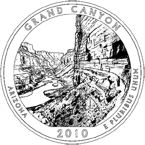
2010 · United States Mint image Official Mint coloring-page line drawing; reverse design by Phebe Hemphill. Design and artist source ↗
United States Mint quarter design · United States Mint. Open source ↗
- Quarter issue year
- 2010
- Retrieved
- 2026-10-30
- Image rights
- Image rights and source ↗
- Evidence
- Single source; not independently corroborated.
- Reuse
- Reverse designed by a Mint staff artist. Coloring-page graphic rights and any underlying third-party rights are not separately established. Do not imply Mint endorsement.
- Rights
- Reverse designed by a Mint staff artist. Coloring-page graphic rights and any underlying third-party rights are not separately established. Do not imply Mint endorsement.
Yaki Point Sunset · NPS/Michael Quinn. Open source ↗
- Information date
- Not supplied by the source
- Retrieved
- 2026-10-30
- Catalog image date
- 08/14/2011
- Source scope
- Grand Canyon National Park
- Evidence
- Single source; not independently corroborated.
- Reuse
- Public domain:Full Granting Rights
- Rights
- Public domain:Full Granting Rights
Designation · National Park System directory. Open source ↗
- Information date
- Not supplied by the source
- Retrieved
- 2026-10-30
- Evidence
- Single source; not independently corroborated.
- Reuse
- Factual reference data; source attribution retained.
State or territory · National Park System directory. Open source ↗
- Information date
- Not supplied by the source
- Retrieved
- 2026-10-30
- Evidence
- Single source; not independently corroborated.
- Reuse
- Factual reference data; source attribution retained.
Park Map - Grand Canyon National Park · National Park Service, Harpers Ferry Center. Open source ↗
- Information date
- Not supplied by the source
- Retrieved
- 2026-10-30
- Source scope
- Grand Canyon National Park
- Download
- Official map PDF ↗
- Evidence
- Single source; not independently corroborated.
- Reuse
- Public domain; NPS map
- Rights
- Public domain; NPS map
Interpretive Themes for Artist and Author · Interpretive Themes for Artist and Author — National Park Service. Open source ↗
- Information date
- Not supplied by the source
- Retrieved
- 2026-10-30
- Source page last updated
- March 16, 2026
- Evidence
- Single source; not independently corroborated.
- Reuse
- NPS-authored U.S. government material is generally public domain; third-party content may have separate rights.
People · People — National Park Service. Open source ↗
- Information date
- Not supplied by the source
- Retrieved
- 2026-10-30
- Source page last updated
- February 18, 2022
- Evidence
- Single source; not independently corroborated.
- Reuse
- NPS-authored U.S. government material is generally public domain; third-party content may have separate rights.
Places · Places — National Park Service. Open source ↗
- Information date
- Not supplied by the source
- Retrieved
- 2026-10-30
- Source page last updated
- September 22, 2019
- Evidence
- Single source; not independently corroborated.
- Reuse
- NPS-authored U.S. government material is generally public domain; third-party content may have separate rights.
Collections · Collections — National Park Service. Open source ↗
- Information date
- Not supplied by the source
- Retrieved
- 2026-10-30
- Source page last updated
- October 28, 2026
- Evidence
- Single source; not independently corroborated.
- Reuse
- NPS-authored U.S. government material is generally public domain; third-party content may have separate rights.
Whose Story Is History? · Whose Story Is History? — National Park Service. Open source ↗
- Information date
- Not supplied by the source
- Retrieved
- 2026-10-30
- Source page last updated
- February 14, 2022
- Evidence
- Single source; not independently corroborated.
- Reuse
- NPS-authored U.S. government material is generally public domain; third-party content may have separate rights.
Associated Tribes · Associated Tribes — National Park Service. Open source ↗
- Information date
- Not supplied by the source
- Retrieved
- 2026-10-30
- Source page last updated
- March 10, 2026
- Evidence
- Single source; not independently corroborated.
- Reuse
- NPS-authored U.S. government material is generally public domain; third-party content may have separate rights.
Explorers · Explorers — National Park Service. Open source ↗
- Information date
- Not supplied by the source
- Retrieved
- 2026-10-30
- Source page last updated
- September 5, 2024
- Evidence
- Single source; not independently corroborated.
- Reuse
- NPS-authored U.S. government material is generally public domain; third-party content may have separate rights.
Miners · Miners — National Park Service. Open source ↗
- Information date
- Not supplied by the source
- Retrieved
- 2026-10-30
- Source page last updated
- November 14, 2022
- Evidence
- Single source; not independently corroborated.
- Reuse
- NPS-authored U.S. government material is generally public domain; third-party content may have separate rights.
Entrepreneurs · Entrepreneurs — National Park Service. Open source ↗
- Information date
- Not supplied by the source
- Retrieved
- 2026-10-30
- Source page last updated
- September 21, 2019
- Evidence
- Single source; not independently corroborated.
- Reuse
- NPS-authored U.S. government material is generally public domain; third-party content may have separate rights.
Grand Canyon Civilian Conservation Corps · Grand Canyon Civilian Conservation Corps — National Park Service. Open source ↗
- Information date
- Not supplied by the source
- Retrieved
- 2026-10-30
- Source page last updated
- April 7, 2026
- Evidence
- Single source; not independently corroborated.
- Reuse
- NPS-authored U.S. government material is generally public domain; third-party content may have separate rights.
Village Historic District · Village Historic District — National Park Service. Open source ↗
- Information date
- Not supplied by the source
- Retrieved
- 2026-10-30
- Source page last updated
- June 17, 2024
- Evidence
- Single source; not independently corroborated.
- Reuse
- NPS-authored U.S. government material is generally public domain; third-party content may have separate rights.
Shrine of the Ages and the Pioneer Cemetery · Shrine of the Ages and the Pioneer Cemetery — National Park Service. Open source ↗
- Information date
- Not supplied by the source
- Retrieved
- 2026-10-30
- Source page last updated
- September 22, 2019
- Evidence
- Single source; not independently corroborated.
- Reuse
- NPS-authored U.S. government material is generally public domain; third-party content may have separate rights.
Research Library · Research Library — National Park Service. Open source ↗
- Information date
- Not supplied by the source
- Retrieved
- 2026-10-30
- Source page last updated
- October 28, 2026
- Evidence
- Single source; not independently corroborated.
- Reuse
- NPS-authored U.S. government material is generally public domain; third-party content may have separate rights.
Museum Collection · Museum Collection — National Park Service. Open source ↗
- Information date
- Not supplied by the source
- Retrieved
- 2026-10-30
- Source page last updated
- October 28, 2026
- Evidence
- Single source; not independently corroborated.
- Reuse
- NPS-authored U.S. government material is generally public domain; third-party content may have separate rights.
History & Culture · National Park Service. Open source ↗
- Information date
- Not supplied by the source
- Retrieved
- 2026-10-30
- Evidence
- Single source; not independently corroborated.
- Reuse
- NPS-authored U.S. government material is generally public domain; third-party material may have separate rights. No images copied.
Ecology · Nature & Science — National Park Service. Open source ↗
- Information date
- May 7, 2026
- Retrieved
- 2026-10-30
- Evidence
- Single source; not independently corroborated.
- Reuse
- NPS webpage text; U.S. government work generally public domain. Third-party material may have separate rights.
Wildlife · Wildlife — National Park Service. Open source ↗
- Information date
- January 20, 2017
- Retrieved
- 2026-10-30
- Evidence
- Single source; not independently corroborated.
- Reuse
- NPS webpage text; U.S. government work generally public domain. Third-party material may have separate rights.
Birds · Birds — National Park Service. Open source ↗
- Information date
- September 30, 2020
- Retrieved
- 2026-10-30
- Evidence
- Single source; not independently corroborated.
- Reuse
- NPS webpage text; U.S. government work generally public domain. Third-party material may have separate rights.
Plants · Plants — National Park Service. Open source ↗
- Information date
- October 21, 2021
- Retrieved
- 2026-10-30
- Evidence
- Single source; not independently corroborated.
- Reuse
- NPS webpage text; U.S. government work generally public domain. Third-party material may have separate rights.
Nature & Science · Nature & Science — National Park Service. Open source ↗
- Information date
- May 7, 2026
- Retrieved
- 2026-10-30
- Evidence
- Single source; not independently corroborated.
- Reuse
- NPS webpage text; U.S. government work generally public domain. Third-party material may have separate rights.
Mammals · Mammals — National Park Service. Open source ↗
- Information date
- March 14, 2024
- Retrieved
- 2026-10-30
- Evidence
- Single source; not independently corroborated.
- Reuse
- NPS webpage text; U.S. government work generally public domain. Third-party material may have separate rights.
Nature & Science · National Park Service. Open source ↗
- Information date
- Not supplied by the source
- Retrieved
- 2026-10-30
- Evidence
- Single source; not independently corroborated.
- Reuse
- NPS-authored U.S. government material is generally public domain; third-party material may have separate rights. No images copied.
Mather Campground - South Rim · National Park Service park structured data. Open source ↗
- Information date
- Not supplied by the source
- Retrieved
- 2026-10-30
- Evidence
- Single source; not independently corroborated.
- Reuse
- NPS-supplied text; NPS-authored U.S. government work is generally public domain, subject to third-party rights.
Desert View Campground (Reservations Required) · National Park Service park structured data. Open source ↗
- Information date
- Not supplied by the source
- Retrieved
- 2026-10-30
- Evidence
- Single source; not independently corroborated.
- Reuse
- NPS-supplied text; NPS-authored U.S. government work is generally public domain, subject to third-party rights.
South Rim - Lodging and Camping · National Park Service. Open source ↗
- Information date
- Not supplied by the source
- Retrieved
- 2026-10-30
- Evidence
- Single source; not independently corroborated.
- Reuse
- NPS-supplied text; NPS-authored U.S. government work is generally public domain, subject to third-party rights.
Today's Key Hiking Messages · National Park Service. Open source ↗
- Information date
- Not supplied by the source
- Retrieved
- 2026-10-30
- Evidence
- Single source; not independently corroborated.
- Reuse
- NPS-supplied text; NPS-authored U.S. government work is generally public domain, subject to third-party rights.
Things To Do · National Park Service. Open source ↗
- Information date
- Not supplied by the source
- Retrieved
- 2026-10-30
- Evidence
- Single source; not independently corroborated.
- Reuse
- NPS-supplied text; NPS-authored U.S. government work is generally public domain, subject to third-party rights.
Physical Address · Official park structured information. Open source ↗
- Information date
- Not supplied by the source
- Retrieved
- 2026-10-30
- Evidence
- Single source; not independently corroborated.
- Reuse
- NPS-supplied text; NPS-authored government work generally public domain, subject to third-party rights.
Mailing Address · Official park structured information. Open source ↗
- Information date
- Not supplied by the source
- Retrieved
- 2026-10-30
- Evidence
- Single source; not independently corroborated.
- Reuse
- NPS-supplied text; NPS-authored government work generally public domain, subject to third-party rights.
Telephone · Official park structured information. Open source ↗
- Information date
- Not supplied by the source
- Retrieved
- 2026-10-30
- Evidence
- Single source; not independently corroborated.
- Reuse
- NPS-supplied text; NPS-authored government work generally public domain, subject to third-party rights.
Recreation visits · National Park Service Visitor Use Statistics. Open source ↗
- Information date
- 2025
- Retrieved
- 2026-10-30
- Methodology
- NPS reporting unit; annual total is the sum of 12 monthly recreation visit estimates.
- Reporting unit
- Grand Canyon NP
- Evidence
- Single source; not independently corroborated.
- Reuse
- Factual reference data; source attribution retained.
